Ph.D. Program in Oceanography and Global Change at the Canary Islands, Spain
Environmental conservation is a key issue towards a green economy that recognizes the relevance of ecosystems to human development and welfare. Aware of this reality and the potential of Earth observation from space, the European Parliament approved in 2013 the funding for Copernicus-GMES (Global Monitoring for Environment and Security) program. Similarly, several recommendations in the document ‘Space Research in Horizon 2020’ highlight the importance of the exploitation of Earth observation satellite data and the development of new processing and analysis techniques.
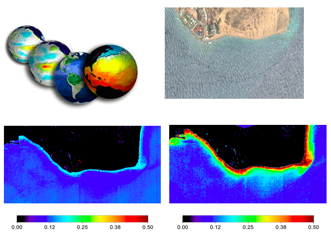
In this context, the aim of this topic is the development of image processing techniques, applied to new satellites, particularly medium and high spatial resolution to obtain accurate and systematic information about areas related to the management of marine natural resources generation and, specifically, the analysis of operational remote sensing products applied to oceanography, climate change and environment.
Achieving this objective entails the generation of knowledge that is embodied in the development of reliable software tools for the analysis, conservation and management of coastal resources, in an automatic, continuous and economic way, and at the suitable spatial and spectral resolution for the phenomena under study, specially applied to climate change.In summary, this project involves the generation of scientific and technological knowledge that will mean a major breakthrough in solving one of the great social challenges identified at National and European (H2020) level.