Ph.D. Program in Oceanography and Global Change at the Canary Islands, Spain
One relevant technology to monitor our oceans, atmosphere or land resources is remote sensing. It has become a very important source of information as a consequence of the considerable progress that satellites have experienced in recent decades, providing a huge amount of images with high spatial, spectral and temporal resolution. Nowadays there are several active and passive platforms observing the Earth at different spectral regions (visible, infrared, microwaves). However, to generate high-level products, it is necessary to apply advanced image processing techniques (corrections, fusion, classification, etc.).
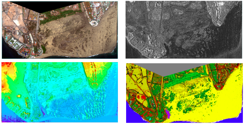
In particular, one challenging research line is the processing of multimodal information from very high resolution remote sensing sensors (A classification example is shown is the figure using Worldview-2, TerraSAR-X and LIDAR data). That information can be very useful in coastal management applications, shallow seafloor mapping, water quality studies, natural protected areas monitoring, change detection analysis, climate change effects, etc.
In summary, data form optical, IR, radar or LIDAR sensors need to be processed to generate products for the management of our planet. The development of improved techniques in the different processing stages is a critical aspect and an active research line of our group.